We had the most exciting adventures in Southern Africa in 2017-2018.
Some highlights!


We had the most exciting adventures in Southern Africa in 2017-2018.
Some highlights!
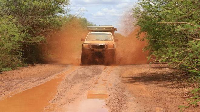
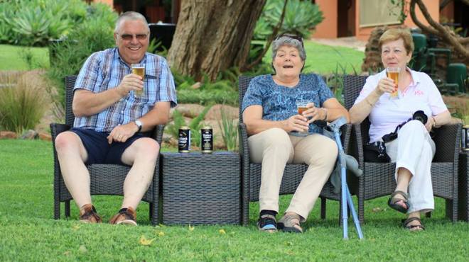
It has been a while since I could place an adventure photo. Some photos to enjoy.
Live Life.


We wish all travellers who has travelled with Afrikaya in 2016, who made it possible for us and we hope a lot of dreams has come true for you!!
May you be blessed for 2017 and safe, may we find peace and happiness around the world and unite as a people’s nation.
Let your journey begin!!!


A self-drive in the Kruger National Park or a safari in a private game reserve? A question asked by tourists and locals alike, time and time again. Surely the animals are the same? One could even argue that between the Kruger and a private game reserve such as the Sabi Sand or Timbavati one could see exactly the same elephant, since the animals have the luxury of roaming freely between the reserves. But that’s rubbish. And here’s why… Botswana has no fences.
My first ever sighting of a hyena was on a main road in the Kruger National Park – it was a hyena pup. What a sight! But instead of being able to follow the hyena through the bush in a 4×4, we were jostling for a vantage point with a bunch of other tourists. In a closed VW Golf. Heads and cameras were outstretched in an ungainly attempt to get a half-decent photo. After half an hour we reached the front of the queue and our reward was a 30 second view of the adorable pup before being hooted at – yes…hooted! Time to move on in search of our next impala.
A real safari is about the overall experience. Tales over pre-dinner drinks from courageous rangers and the sudden use of the flash light during dinner to see the hippo in front of the deck all create the memories that urge us to return at the first opportunity. It’s about submerging yourself in an African fantasy while at the same time seeing real nature in all its spectacular (and at times brutal) glory. It’s about stepping up onto a safari vehicle in search of the Big 5. It’s about the thrill of marauding through the bush after a pack of wild dogs in hot pursuit of an impala.
Why is the game viewing better in a Private Game Reserve?
It’s private! No cars of other tourists in a dazzling array of blinding colours.
Safari vehicles can go off road. In a national park you will be limited to animals visible from the main roads.
The best and most knowledgeable rangers in the business work at the private game reserves.
Rangers are not restricted to national park hours, which means that they can go on night drives. It also means that you can stay as long as you want on a sighting!
Elevated, open-top safari vehicles give you the best view possible so you can get the perfect photo.
Rangers can lead walking safaris so that you can get that perfect photo right up the rhino’s nostril!
You might often hear about about ‘traversing rights’ in reference to your safari experience. So what are traversing rights? Traversing rights allow neighbouring lodges to drive on each others’ land which means more space for you to explore and find animals. The larger the traversing area the better! More land = more biodiversity. Limpopo, Mpumulanga and in KwaZulu-Natal.
Through all my experience and the way I love what I’m doing as Tourist Guide in South-Africa?
Old videos I wish to share with all!
Relax sit back and enjoy!
visit websites:
http://www.afrikayaleisuretravel.com
P.S. We do small group tours through Southern Africa max of 6-12 people.
We have decided to make use of National Geographic’s video.
Our 17 & 25 day tours go through South-Africa, Swaziland and Lesotho (4X4).
Our 29 day tour go through Namibia, Botswana and visiting Victoria waterfalls (Zimbabwe side).
Mozambique is great place to visit for snorkelling and scuba diving.
Visit: http://www.afrikayatours.com
http://www.afrikayaleisuretravel.com
Watch the movie!
http://video.nationalgeographic.com/video/destinations/africa-south-dest?source=searchvideo
For the past few years we have travelled through Southern Africa.
As a tourist guide and tour operator in Southern Africa I’m proud to show some of our photos.
Enjoy and hope to see you on our next tour with:
Afrikaya Tours and Afrikaya Leisure Travel!!!!!
From Margreet van Belle and Wynand Meyer.
We wish to thank you all for making this tours all possible!!!


Botswana

The Makgadikgadi Pan, a salt pan situated in the middle of the dry savanna of north-eastern Botswana, is one of the largest salt flats in the world. The pan is all that remains of the formerly enormous Lake Makgadikgadi, which once covered an area larger than Switzerland, but dried up several thousand years ago.
Lying southeast of the Okavango Delta and surrounded by the Kalahari Desert, Makgadikgadi is technically not a single pan but many pans with sandy desert in between, the largest being the Sua (Sowa), Nwetwe and Nxai Pans. The largest individual pan is about 1,900 sq mi (4,921.0 km2). In comparison, Salar de Uyuni in Bolivia is a single salt flat of 4,100 sq mi (10,619.0 km2), rarely has much water, and is generally claimed to be the world’s largest salt pan. A dry salty clay crust most of the year, the pans are seasonally covered with water and grass, and are then a refuge for birds and animals in this very arid part of the world. The climate is hot and dry but with regular annual rains.
The main water source is the Nata River, called Amanzanyama in Zimbabwe, where it rises at Sandown about 37 mi (59.5 km) from Bulawayo. A smaller amount of water is supplied by the Boteti River from the Okavango delta.
These salt pans cover 6,200 sq mi (16,057.9 km2) in the Kalahari Basin and form the bed of the ancient Lake Makgadikgadi, which evaporated many millennia ago.Archaeological recovery in the Makgadikgadi has revealed the presence of prehistoric man through abundant finds of stone tools; some of these tools have been dated sufficiently early to establish their origin as earlier than the era of Homo sapiens. Pastoralists herded grazing livestock here when water was more plentiful earlier in theHolocene.
The lowest place in the basin is Sua Pan with an elevation of 2,920 feet.
As the ancestral Lake Makgadikgadi shrank, it left relict shorelines, which are most evident in the southwestern part of the basin. As the lake shrank numerous smaller lakes formed with progressively smaller shorelines. The relict shorelines at elevations of 3100 feet and 3018 feet can be seen mostly easily on Gidikwe Ridge, west of the Boteti River.
The geologic processes behind the formation of the basin are not well understood. It is conjectured that a there was a gentle down-warping of the crust, with accompanying mild tectonics and associated faulting; however, no significant plate boundary faults have been identified. The main axis of the developing graben runs northeast-southwest.
Kubu Island and Kukome Island are igneous rock “islands” in the salt flat of Sua pan. Kubu Island lies in the southwestern quadrant of Sua Pan, contains a number of baobab trees, and is protected as a national monument.
The pans themselves are salty desert whose only plant life is a thin layer of blue-green algae. However the fringes of the pan are salt marshes and further out these are circled by grassland and then shrubby savanna. The prominent baobab trees found in the area function as local landmarks. One of them, named after James Chapman, served as an unofficial post office for 19th-century explorers.
Very little wildlife can exist here during the harsh dry season of strong hot winds and only salt water, but following a rain the pan becomes an important habitat for migrating animals including wildebeest and one of Africa’s biggest zebra populations, and the large predators that prey on them. The wet season also brings migratory birds such as ducks, geese and Great White Pelicans. The pan is home of one of only two breeding populations of Greater Flamingos in southern Africa, and only on the Soa pan, which is part of the Makgadikgadi pans. The other breeding population is at Etosha, in the Northern part of Namibia. The only birds here in the dry season areostriches, Chestnut-banded Plover (Charadrius pallidus) and Kittlitz’s Plover (Charadrius pecuarius). The grasslands on the fringes of the pan are home to reptiles such astortoises, rock monitor (Varanus albigularis), snakes and lizards including the endemic Makgadikgadi spiny agama (Agama hispida makgadikgadiensis).
The salt pans are very inhospitable and human intervention has been minimal so they remain fairly undisturbed, although land surrounding the pans is used for grazing and some areas have been fenced off, preventing the migration of wildlife. Modern commercial operations to extract salt and soda ash began on Sua Pan in 1991, and there are also plans to divert water from the Nata River for irrigation, which would cause severe damage to the salt pan ecosystem. Another threat is the use of quad bikes and off-road vehicles by tourists, which disturbs breeding colonies of flamingos. Illegal hunting in the national parks is a persistent problem.
There are some protected areas within the Makgadikgadi and Nxai Pan National Park. The Makgadikgadi Pans Game Reserve is the scene of large migrations of zebra and wildebeest from the Boteti River across to Nwetwe Pan, while the Nata Sanctuary in Sua Pan is a place to see birdlife and antelopes. In Nxai Pan you can still see thebaobabs painted by 19th century British artist Thomas Baines. The area can be accessed between the towns of Nata and Maun or from the town of Gweta.

Etosha National Park is a national park in northwestern Namibia. The park was proclaimed a game reserve on March 22, 1907 in Ordinance 88 by the Governor of German South West Africa, Dr. Friedrich von Lindequist. It was designated as Wildschutzgebiet Nr. 2 which means Game Reserve Number 2, in numerical order after West Caprivi (Game Reserve No. 1) and preceding Namib Game Reserve (No. 3). In 1958, Game Reserve No. 2 became Etosha Game Park and was elevated to status of National Park in 1967 by an act of parliament of the Republic of South Africa which administered South-West Africa during that time.
Etosha National Park spans an area of 22,270 square kilometres (8,600 sq mi) and gets its name from the large Etosha pan which is almost entirely within the park. The Etosha pan (4,760 square kilometres (1,840 sq mi)) covers 23% of the area of the total area of the Etosha National Park.[2] The park is home to hundreds of species of mammals, birds and reptiles, including several threatened and endangered species such as the black rhinoceros.
The park is located in the Kunene region and shares boundaries with the regions of Oshana, Oshikoto and Otjozondjupa.
As we are frequently visiting these areas, more about The Kalahari Desert.


The Kalahari Desert (in Afrikaans Kalahari-woestyn) is a large semi-arid sandy savannah in southern Africa extending 900,000 square kilometres (350,000 sq mi), covering much of Botswana and parts of Namibia and South Africa. A semi-desert, with huge tracts of excellent grazing after good rains, the Kalahari supports more animals and plants than a true desert, such as the Namib Desert to the west. There are small amounts of rainfall and the summer temperature is very high. The driest areas usually receive 110–200 millimetres (4.3–7.9 in) of rain per year, and the wettest just a little over 500 millimetres (20 in). The surrounding Kalahari Basin covers over 2,500,000 square kilometres (970,000 sq mi) extending farther into Botswana, Namibia and South Africa, and encroaching into parts ofAngola, Zambia and Zimbabwe. The Kalahari is home to many migratory birds and animals. Previously havens for wild animals from elephants to giraffes, and for predators such as lions and cheetahs, the riverbeds are now mostly grazing spots, though leopards and cheetahs can still be found. The area is now heavily grazed and cattle fences restrict the movement of wildlife. Among deserts of the southern hemisphere, the Kalahari most closely resembles some Australian deserts in its latitude and its mode of formation.
